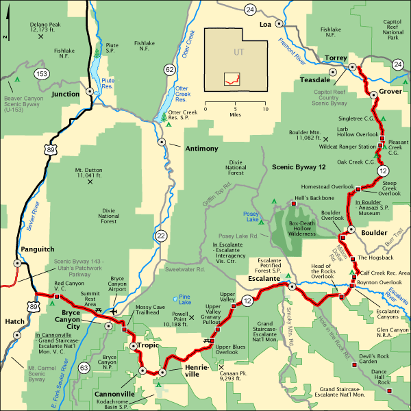
If you are a visitor to Utah, chances are you are there to visit the National Parks, a plan that is highly recommended for all who enjoy natural wonders. The bonus is that you can travel by way of the Scenic Byway 12 between Capitol Reef National Park and Bryce Canyon National Park. You will discover it is a drive that is almost a National Park in itself, when it comes to stunning scenic beauty. Named an “All American Road” in 2000 and ranked as the “Second Most Beautiful Highway in the World”, the drive is as dramatic as the destinations.
US Department of Transportation / Federal Highway Administration
Begin at the town or Torrey, your northeastern gateway to Scenic Byway 12, and the nearest town to Capital Reef National Park. Torrey is named for a colonel who raised a regiment during the Spanish American War from among the local ranchers and miners. The old log schoolhouse at Torrey is a much photographed Utah Historic Site, with its red sandstone and bell tower.
At Capitol Reef National Park, begin at the Visitor Center, constructed of native stone, where park visitors a have been welcomed since 1966. Take the scenic road to see many of the park’s famous formations including Historic Fruita, Grand Wash, Cassidy Arch, and the Petroglyph Panel from the Fremont Culture.

“Cassidy Arch, Capitol Reef National Park” by Bigtimepeace – Own work. Licensed under Public Domain via Wikimedia Commons.
Continuing on Scenic Drive 12, you will come to Grover, a small ranching community. Grover’s chief point of interest is the old schoolhouse which was built in 1935, closed in 1941, and placed on the national register of historic places in 1986.
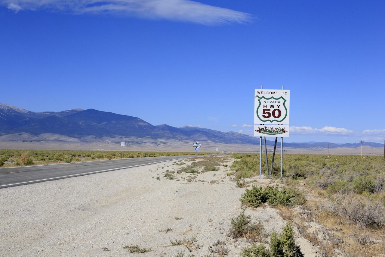
There will be many overlooks provided for you on your route, we encourage you to stop at as many as you are able. For example, Lamb Hollow Overlook which provides vistas of Waterpocket Fold, forests and a lake, as well as Capitol Reef and the Le Sal mountains in the background. A bit further along, Homestead Overlook, high on the Aquarius Plateau, offers panoramas from a vantage point of 9,400 feet. The Henry Mountains loom in the distance to the east; these were the last mountain range to be mapped in all of the lower 48 states.

“Henry Mountains, Utah, 2005-06-01“. Licensed under CC BY-SA 2.5 via Wikimedia Commons.
Above Boulder, the Boulder Overlook provides great views down into the valley where the town nestles. Near Boulder, visit the Anasazi Museum, with displays of Anasazi artifacts, walls, and buildings from an ancient Native American village. This was once one of the largest Ancestral Puebloan communities west of the Colorado River. Also called the Coombs Site, dates to AD 1160-1235 and was home to as many as 200 people.
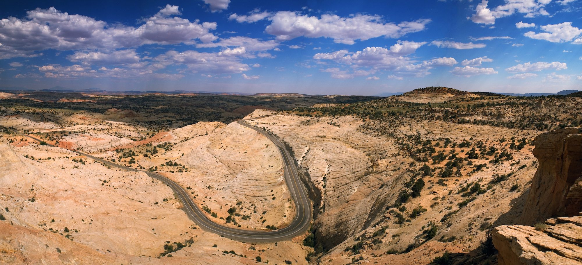
At t his point you have two options, one is to continue on Scenic Route 12 over The Hogsback, the most dramatic portion of the journey. Or if you wish, you may take the alternate road called Hells Backbone for a different driving experience.
The Hogsback provides the most thrilling stretch of miles along Route 12 as it takes you on a narrow ridge winding with drop-offs on both sides of the road. You are up there with the sky and the birds, with dramatic canyons. On the one side is Boulder Creek and the other, Calf Creek. Driving The Hogsback is like doing a high wire act. Many years ago the road was even more thrilling, since there was only one lane; so traffic could only cross in one direction at a time. Now it is standard two lane width. Be sure to try some of the turn-offs where you can make some great photos, and let the local traffic hurry along, as you linger and savor the scenery. This stretch of road was nicknamed The Million Dollar Highway because that was the amount spent in 1935 for the Civilian Conservation Corps to build it.

“Hells Backbone-Bridge” by Caddymob (talk) Jason J. Corneveaux (http://corneveaux.com) Licensed under CC BY-SA 3.0 via Wikipedia.
If you take Hell’s Backbone Road you will be on a gravel, high-country alternative to the paved stretch of 12 that includes The Hogsback. Officially Forest Road 153, it was built in the mid-1930s as an alternate route between the towns of Escalante and Boulder, Utah. It was also constructed by the Civilian Conservation Corps and created a means for the first automobiles to reach Boulder. It is not for the faint of heart. If you are all for daring driving, do take it. Keep in mind that muddy weather makes the road impassible for passenger cars. Halfway along the road is the much photographed Hell’s Backbone Bridge, which is 109 feet long, 14 feet wide, over a 1,500-foot drop on either side.
Boynton Overlook provides another look at the road from above, just before the Escalante River. At Calf Creek Recreation Area you have one of the most accessible ways to see the spectacular scenery up close. Park here all day for a modest fee, and take the trail – make plans for the half day hike if possible; or enjoy a picnic among the cottonwood trees.
You will have a wonderful drive if you stay on Scenic Route 12, but one of the best kept secrets is a side trip from Escalante. Upper Calf Creek Falls is an 88 foot cascading waterfall upstream from Lower Calf Creek. It is secluded behind a steep sandstone incline, lined with volcanic boulders and hidden from trail-view behind the trailhead register. The route to the fall is two miles, roundtrip, and we advise at least two hours to make the uphill climb and find the hidden location.
Grand Staircase Escalante National Monument is just a tad larger than the state of Delaware which comprises 2,491 sq miles, one of those landscape size comparisons people love. (The other is Rhode Island at 1,212 sq miles). This amazing geological formation does resemble a grand staircase of prodigious proportions. The rock formations are as fantastic as their names imply: Spooky Gulch, Devils Garden, the Four Hoodoos, and best of all, Peek-a-Boo Gulch.
Willis Creek Slot Canyon is where Willis Creek flows along the edge of Grand Staircase Escalante National Monument. If you want to see the scene up close, this is a fairly easy hike following a flat stream bed through the deeply sculpted canyon. Do not attempt this hike if there is rain in the area. At the Upper Valley Granary Pullout stop to look high up on the cliff through the view ring provided, to see, in a cleft in the cliff, a small mud and stone structure built by ancient Puebloans. Archeologists believe it was once used to store grain.

“Clouds over Kodachrome Basin State Park” by Photographersnature – Own work. Licensed under CC BY-SA 3.0 via Wikimedia Commons.
At Cannonville, visit the Grand Staircase Escalante Nation Monument Visitors Center to learn more about the area. And consider another off route side trip. There is truly so much to see, that visitors often miss the grand sights of the Kodachrome Basin State Park, which is one of the best hidden secrets of the region. Situated 8 ½ miles south of Cannonville, it is worth the detour. There are sixty-seven sand pipes, ranging from six to 170 feet, in the park. The effect is other-worldly. Be cautious and know the weather forecast before using this road, which is prone to dangerous flash flooding.

“RedCanyonScenicByWay” by Kasiarunachalam – Own work. Licensed under CC BY-SA 3.0 via Wikimedia Commons.
Continue along Scenic Route 12 to Bryce Canyon National Park, where everything from Inspiration Point to Queen Victoria awaits you. There are many lovely loop hikes as well as the scenic drive that allow you to visit many of the features of this amazing national treasure. As we did with Capitol Reef National Park, we encourage you to read the Drive the Nation article about Bryce to learn more about what to see and do there.


