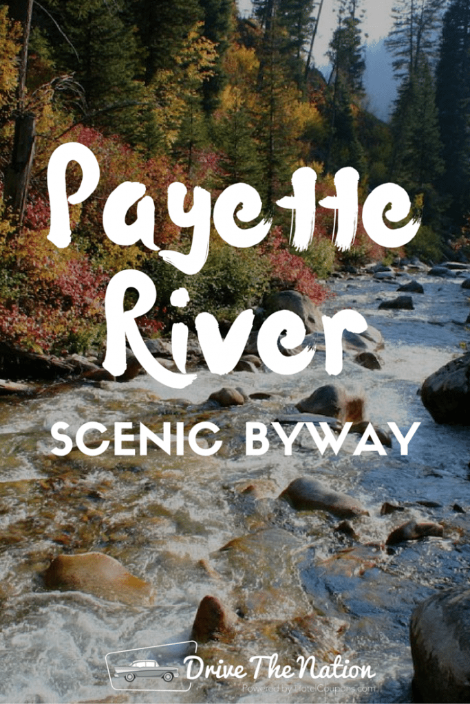
When you next travel through Idaho, you can take the scenic route, State Highway 55, which is the officially designated Payette River Scenic Byway. The route is 111.7 miles and would take about 2 ½ hours to drive without stops. But do plan to stop and enjoy the scenery along the way.
Begin where Idaho 44 and Idaho 55 meet, west of Boise. Then take 55 north along the valley of the Payette River. You will traverse portions of the Boise National Forest and the Payette National Forests and pass through Cascade and McCall before you come to the end of the byway in New Meadows. From your windows, you will see mountains, streams, rivers, and forests, and from the occasional pull-offs you can stop to savor the sight, sound, smell, and spray from Idaho’s famous whitewater.
The town of Horseshoe Bend is named for the bend of the same name on the Payette River. With a population of just over 700, Horseshoe Bend is not a large place, but it is big on scenery. If you want to do some white water river kayaking, this is a good place to do it. Or consider a zip line through the foothills. There is more than one channel of the river here, to help the river roll along. Sonora Mexican Restaurant is a popular place to dine in Horseshoe Bend, order their fresh made guacamole, fajitas, and carne asada. The most popular attraction in the Horseshoe Bend area is the Thunder Mountain Line, the only scenic train rides in the state of Idaho. Follow along the Payette River through the Boise National Forest, with views of the white water kayakers and rafters. A typical trip stops for about 40 minutes in Banks so that riders may visit a gold mining exhibit, photography a stage coach, and see the old station house. Order a box lunch when you make your reservations. If you do not travel the trip by rail, you can see Banks when you arrive there by car. Banks is a good spot from which to watch kayakers and white water rafters, even if you do not join in those sports.
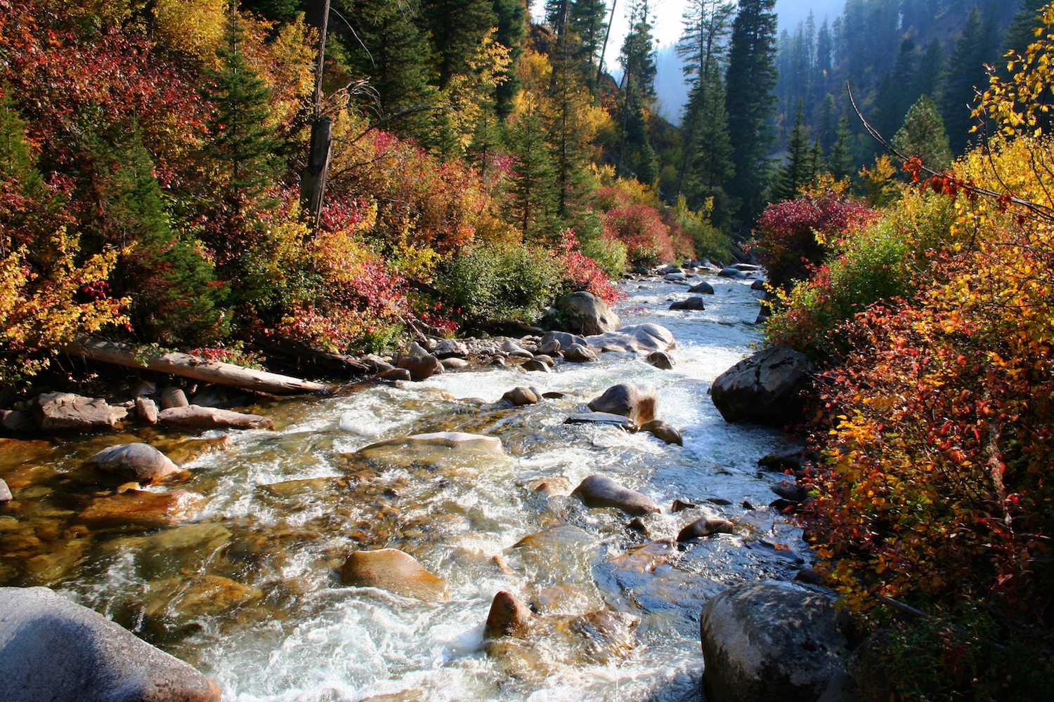
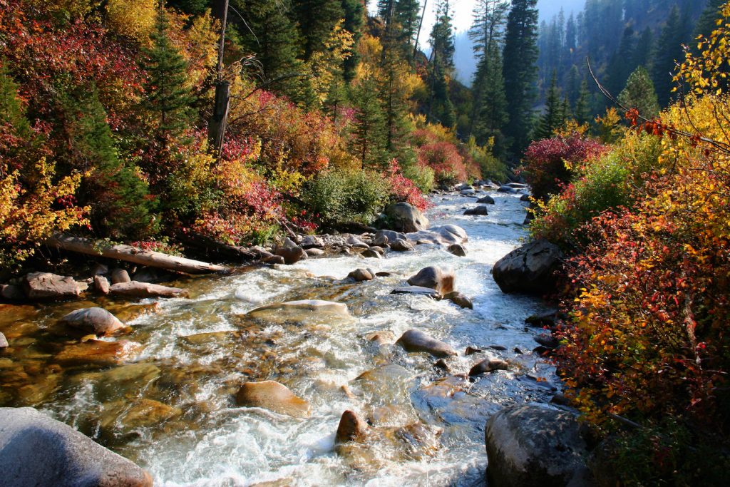
Smiths Ferry is located where the Payette River’s North Fork broadens and calms. It is growing but currently has a population of just over 100. North of Smith’s Ferry the valley narrows considerably and you are treated to tight curves along the steep forested banks of the P River.
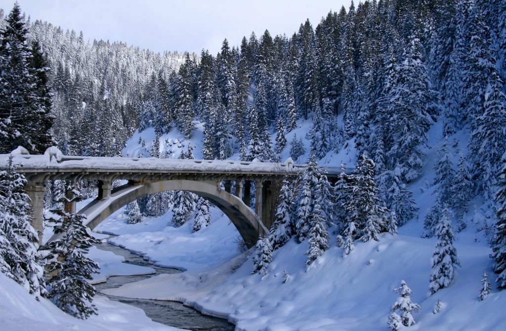
Rainbow Bridge is the longest concrete arch bridge in Idaho, and in such a great location with the river beneath and the forest all around that is often the subject of calendars, jigsaw puzzles, and car commercials. There is a very narrow pull out just before and in sight of the bridge where you can stop and photograph Rainbow Bridge in its American Alpine setting. Please do not try to walk across the bridge as it is quite narrow and there is no sidewalk. The winding, narrow road continues until it opens up into a broad valley as you approach Cascade.
Cascade is a small city with shops, eateries, and recreation centered upon Lake Cascade. The Ashley Inn is a local landmark and has a nice bed and breakfast feel to it. There are also natural hot springs in many places around Cascade, tucked into the mountains for the adventurous looking for undeveloped springs. Kelly’s Whitewater Park is a free park in Cascade; enjoy the 3.4 acres of beautifully landscaped grounds or walk across the bridge to the island to relax by the river. As for meals, try Reo Pizza.
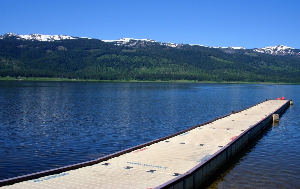
As you leave Cascade your route takes you through ranch land on the eastern side of Cascade Lake. When you cross West 4 Lane, you would think that you were part of that famous “prairie stop” scene in the movie “North by Northwest”, except for the mountains in the distance. Then you come to pretty water and mountain views to the west as the road gets very close to the north end of Lake Cascade. At Donnelly, the Buffalo Gal, or Cougar Dave’s both offer outstanding eating in the “wilds” of Idaho. Black Pine Deer Farm, just south of McCall, is a great place to experience deer up close; the best time to go is in the spring when there are new fawns.
 McCall is a resort town and the largest town along the route, snuggled up to the shores of Lake Payette. Swim at Shellworth Beach. McCall is also a winter destination for snow sports. Take a boat tour of Payette Lake, a tradition dating back 100 years. Places to stay include McCall Hotel centrally located downtown on the lake, Best Western Plus, Bear Creek Lodge, and Shore Lodge, a historic rustic-grand hotel on the shores of the lake. Dining is wide-ranging; try Stacks, Steamers or Pueblo Lindo. The Clubhouse sits on the foothill of Jug Handle Mountain and is a best-kept secret of the McCall area. Go for the sunset views, great lunches or evening specials. In-town traffic tends to be heavy but as soon as you are out of town the road opens up so you can enjoy the passing scene. At the north end of town, a favorite is Paul’s Market where you can stop to buy provisions for en route snacks or a roadside repast. Once out of town, the route is through a forest of towering evergreens, at first gently then more dramatically curving. The route descends dramatically downward with lot s of s curves that eventually opens up to into Historic Meadows Valley.
You reach the end of the Payette River Scenic Byway at New Meadows, a hamlet located half way between Boise and Lewiston in the heart of the heartland of Idaho. It is called New Meadows because after the railroad arrived the buildings of the original town of Meadows was moved several miles to New Meadows by ox car. This was the terminus and corporate headquarters of the Pacific and Idaho Northern Railway. The historic railroad station building is the town’s historic landmark, open for tours.

